
Eagle Pass Neighbor Record Sources
Public records can describe the block around an Eagle Pass address without becoming a roster of every person there. The Maverick County Appraisal District is the current starting point because it links a parcel to an owner, a situs address, a mailing address, a legal description, values, and a deed-history summary. The mailing address is where tax correspondence goes. It may be an agent, a post-office box, or another city, so it does not establish who lives at the parcel.
| Block record | What it can show nearby | Access channel |
|---|---|---|
| CAD parcel search | Indexed owner, situs and mailing addresses, parcel IDs, legal description, values, and deed-history summary | Free web search by owner, address, or identifier |
| Recorded plat | Lot, block, tract, streets, easements, and the legal framework for adjoining land | Maverick County Clerk index, historic volumes, or microfilm |
| City planning maps | Zoning, city limits, flood, thoroughfare, and historic-preservation context | City maps page and linked ArcGIS or PDF layers |
| Recorded deed | Grantor, grantee, instrument, legal description, and transfer date | TexasFile from July 29, 1992, then clerk or historic microfilm |
| Permit or code docket | Address-linked project or posted case information when the record includes an address | Community Development request, court docket PDFs, or municipal court request |
| Voter-file request | Statutory fields subject to confidentiality and permitted request rules | County or state request, not the individual lookup as a block browser |
Start with the property record, then use a recorded plat to determine whether lots actually meet. Nearby map shapes alone do not prove a legal boundary. The official city planning page has zoning and other map layers, but research did not locate a public Maverick County parcel viewer with owner popups, click-adjacent parcels, buffer tools, or a radius feature. That gap matters. It prevents a map-based claim about who is next door from being treated as a property record.
Eagle Pass Neighbor Parcel Matching
The reproducible parcel method is record-first. CAD permits owner, address, Property ID, Geographic ID, subdivision, neighborhood, and advanced searches. Its street-name instructions say to omit a prefix, suffix, and unit number, then try only the street name if a formatted address fails. Save each returned account separately. A street can contain duplicate tax accounts, rural tracts without a familiar street number, and several parcels with the same owner or mailing address.
- Find the target address in CAD and preserve its Property ID, Geographic ID, situs, mailing address, subdivision, and legal lot, block, or tract.
- Locate the recorded plat using that legal description. Record the neighboring lot or block labels, rights-of-way, and easements.
- Search each named lot or adjoining street number in CAD. Compare the Geographic ID and legal description instead of deduplicating by owner name.
- Confirm a transfer through the County Clerk's deed index by instrument number, volume and page, or legal fields.
- Use the city map layers only to add regulatory or location context. For a complete named-street record chain, use the Eagle Pass street directory.
A parcel is land for tax and legal purposes. Its situs address is the physical location. A plat is a recorded map that identifies lots, blocks, streets, and easements. Those terms provide a safer bridge from an address to nearby legal parcels than an informal visual guess about the block.
Note: Preserve the tax year and source date because appraisal data, owner information, and portal controls can change after a search.
Eagle Pass Neighbor Map Context
The city maps around Eagle Pass are still useful, but for a narrower task. The planning page links a zoning ArcGIS map and city-limits, flood-hazard, thoroughfare, and historic-preservation maps. A block may have an Eagle Pass postal line while lying outside the city limit or in unincorporated Maverick County. Compare the CAD situs, legal description, and the city-limits layer when jurisdiction matters. Do not use a postal label or a zoning line as a substitute for a deed or plat boundary.
Research found no official countywide parcel GIS with verified identify, adjacent-parcel, measurement, or buffer mechanics. The safe sequence is target CAD account, recorded plat, neighboring lot or block identifiers, CAD search, and deed confirmation. That process is slower than clicking an imagined map tool, but it can be repeated by another researcher and it keeps the distinction between context and ownership clear.
Map limit. City zoning, flood, and city-limits layers describe regulatory context; the recorded plat and deed establish the legal parcel relationship.
Eagle Pass Neighbor Confirmations
Use address-keyed city records as a limited second layer after confirming the parcel. Eagle Pass Community Development's residential permit form asks for job address, MCAD Property ID, legal description, owner and contractor details, work type, square footage, project cost, and issuance fields. It is a helpful way to request a narrow address and date-range record, but no public searchable completed-permit index was located. A blank form is not proof that a permit was issued.
Code Enforcement does not provide a public address-search portal in the material inspected. The Municipal Court posts dated dockets, and a docket may show a defendant, status code, violation wording, court date, and police or case reference. Pair a docket row with a court request and the CAD or plat record only if an address is actually present. The official Court Dockets page shown below is the source for dated docket links, not a block directory.
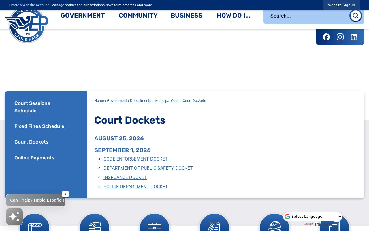
The screenshot supports a request for a dated court or code record. It does not show that every nearby parcel or person appears in a docket, and a listed case is not a final disposition or identity match.
| Official record path | Commercial neighbor tools |
|---|---|
| Names a custodian, source date, and record purpose; supports a request for the underlying item | May combine property, marketing, and other data with unclear update dates or same-name matches |
| Requires a plat or deed to establish legal adjacency | Should not be treated as a legal boundary or complete household list |
| Allows a result to be checked with CAD, clerk, or court staff | Can provide a lead only, not verification |
Eagle Pass Neighbor Voter Limits
The Texas My Voter Portal is an individual status and polling-place route, not a browseable block list. It uses a Voter Unique Identifier and date of birth, a Texas driver-license route and date of birth, or a name route with county, date of birth, and ZIP. Election history can show that someone voted in an election, never how that person voted. Texas does not ordinarily register voters by party in the application process.
A full file uses a different process. Texas Form 24-1 allows county, precinct, Texas mailing-address, effective-date, age, and election-participation filters, but requires a notarized noncommercial-use affidavit, a $75 deposit, and full payment before release. Election Code Sections 18.066 and 18.067 govern timing and use; use for advertising or promoting commercial products or services is a Class A misdemeanor. Confidential fields and protected addresses stay out of the release. Never turn an individual voter check into a public block roster.
Note: Voter addresses can be protected, and ballot choices remain secret even when public voter-file fields are available by statute.
Eagle Pass Neighbor Community Channels
No named current Eagle Pass neighborhood-association directory, homeowner roster, or public member list was verified in the research. The City's 2018 comprehensive-plan draft discusses neighborhood associations as a civic channel, but it is clearly marked draft and not adopted. The MPO public-participation material identifies homeowner, neighborhood, resident, faith-based, and civic groups as audiences, not as a directory of members. That distinction protects private contacts and keeps a planning document from being mistaken for a neighborhood roster.
City Planning
Planning maps and forms provide city map context and planning-record routes. No verified association directory is posted there.
Eagle Pass Chamber
The city resource directory lists the Chamber at 400 Garrison Street, 830-773-3224. It is a business-information channel, not a household list.
Public Library
Eagle Pass Public Library has reference and catalog links. Ask staff to forward a message or identify public local-history material rather than disclose private contact information.
Community history can supply older context without exposing a present block. UNT's Eagle Pass Guide, News-Guide, and Eagle Eye have searchable OCR and page images, while organizations, churches, veterans groups, and alumni groups may choose to forward a message. No public membership roster should be assumed from a contact page, an event notice, or a newspaper mention.
Eagle Pass Neighbor Privacy
Property records identify ownership interests, not every person at an address. Non-owner occupants, household members, children, utility customers, delivery customers, motor-vehicle records, and private organization members do not become a public block view through CAD. Texas motor-vehicle personal information is restricted by the Driver's Privacy Protection Act, Texas Transportation Code Chapter 730, and Government Code Section 552.130. Protected voters and Address Confidentiality Program participants have additional limits.
Lawful use. Use property and civic records for personal, lawful research, civic context, or reconnecting through respectful channels. Do not use records to watch, threaten, stalk, harass, or harm anyone.
The City of Eagle Pass submission page identifies an online Court Records Request form. The screen below documents that official request route, while the field inventory, fees, retention period, and certified-copy options remain unverified.
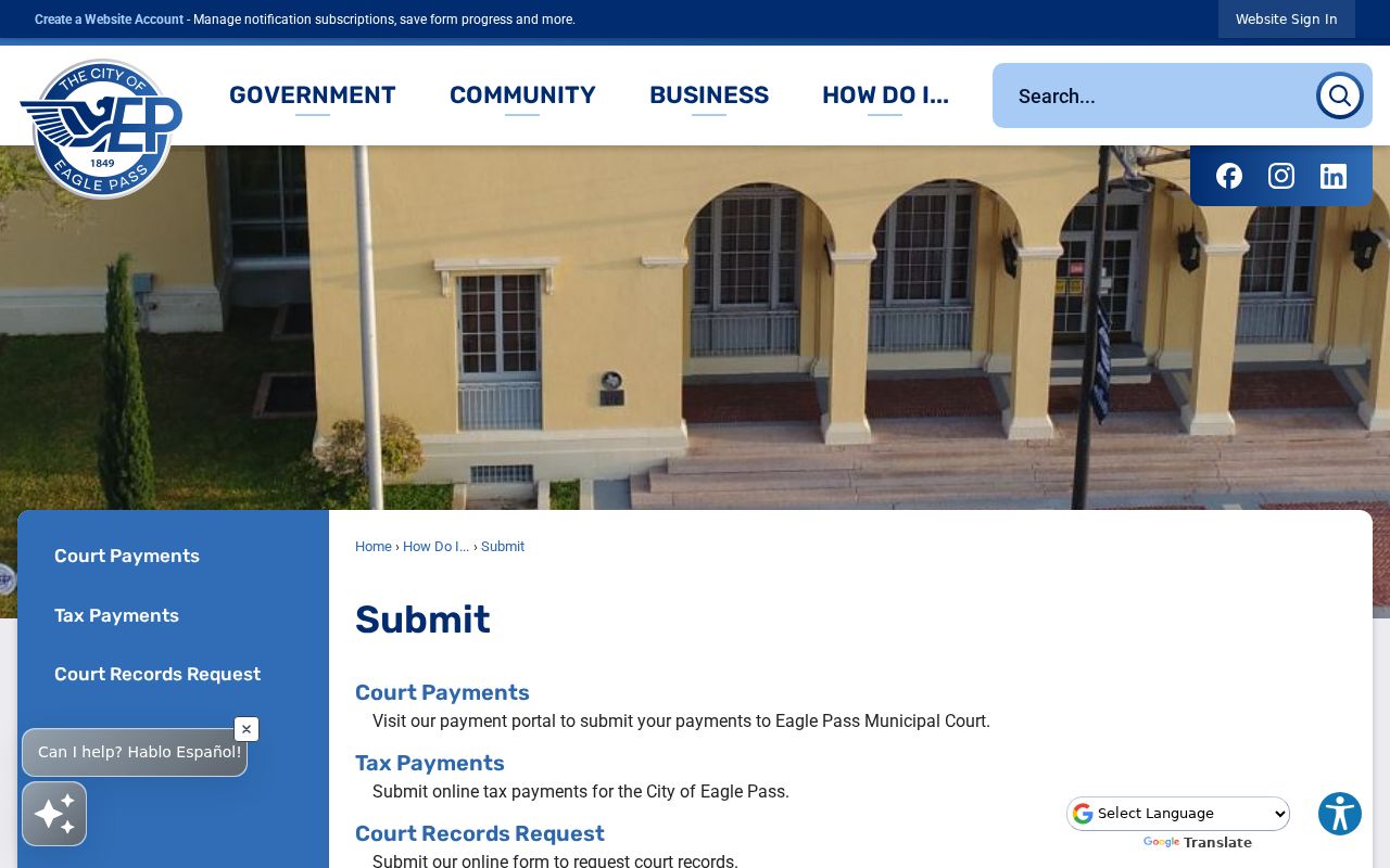
Use a request to seek a defined department record, address, and date range. An office may withhold protected information, and a request does not require it to create a new neighbor list.
Eagle Pass Neighbor History
Older blocks need different evidence. The Library of Congress has an Eagle Pass Sanborn map from April 1916 with seven sheets. It can show building, street, and land-use context, but it is not a modern parcel boundary. Pair a sheet with a recorded legal description, plat, and date. The city history also describes the movement from Fort Duncan and California Camp into the Twohig townsite, so an old record can use a place name rather than a present street number.
Eagle Pass records are fragmented by era. The online Maverick land index begins July 29, 1992, while microfilm deed indexes reach 1871 through 1923. The Texas State Library Maverick County inventory also lists tax rolls, probate minutes, county minutes, naturalization, and election materials. Use the record's date and geography before calling a historic owner or notice part of the current block.